

CO2 sequestrata

Alberi piantati

Produzione agricola

Popolazione coinvolta
The objective of the Life Vaia project is to restore forest areas and enhance their ecosystems through the application of innovative forestry techniques, developing products and services in a sustainable manner. The project is part of the European Union’s broader strategy aimed at protecting forests from damage caused by climate change, strengthening local ecosystems and protecting biodiversity.
The Vaia storm, which hit northern Italy in October 2018, caused a total of 42 million trees to be felled over an area of 41,000 hectares. Hence the need for sustainable forestry redevelopment of the areas affected by the storm, devising a production strategy focused on local resources and the readaptation of the damaged areas, which will also limit the economic damage suffered by the communities living in the affected areas.
The innovative element of the project is the use of the agroforestry strategy as a solution to cope, in the short and long term, with the damage caused by this external climatic event.
The main actions financed by LIFE VAIA concern the breeding and cultivation of wild blueberries and other small ‘wild’ fruits and medicinal plants in forest ecosystems, as well as the enhancement of bee production in forest areas destroyed by the storm.
LOCATION OF THE INTERVENTION AREAS
Two areas have been identified that present more suitable characteristics for the realisation of
- cultivation areas (about 1.6 ha in total)
- reforestation areas (about 8 ha in total)
- areas for beekeeping activities (1 area)
- reservoirs for water collection and irrigation systems
- protective fences
PILOT SITE IT3 – MONTE ZEBIO
The pilot site, measuring approximately 1 square kilometre, is located in the lowest part of the slope that leads from the central plain of Asiago to the summit of Mount Zebio. The area is configured with an elongated shape in an east/west direction and includes two areas particularly affected by crashes during storm Vaia, i.e. the southernmost part of the orographic right of the Val di Nos and the orographic right of the so-called Pista Stalder.
The ‘Calcara della Nasa’ Pilot Area
The pilot area is located at Calcara della Nasa at an altitude of approximately 1,300 metres. Within it, two sub-areas of approximately 2.2 hectares each and 6 areas to be used as forest gardens have been identified for a total area of 4,000 square metres.
“Pista Stalder” Pilot Area
It is located at Pista Stalder at an altitude of approximately 1370 m. Two sub-areas of approximately 2.5 hectares each and four areas for forest gardens have been identified within it.
Types of species that can be cultivated in forest gardens
In each pilot site, a transitional agroforestry system will be implemented in which different types of crops (small fruits, food and phytotherapeutic plants, etc.) will be grown in small areas surrounded by areas undergoing reforestation post Vaia.
Small fruits:
- Blueberries
- Raspberry
- Wild strawberry
- Common Blackberry
- Currant, Gooseberry
Herbaceous species with phytotherapeutic/phytohalimurgical properties:
- Baneberry
- Red bramble
- Alpine Blue Sow-thistle
- Common juniper
- Common elderberry
- Wild blackthorn
- Barberry
- Dogwood
Apiculture
Within the ‘Calcara della Nasa’ Pilot Site, beehives (5 colonies) will be positioned for production and monitoring.
LOCATION OF THE INTERVENTION AREAS
The identification of the pilot area and the pilot sites was carried out through a reconnaissance of the forest areas damaged by storm Vaia in the Municipality of Gallio. This reconnaissance identified pilot area IT4 – Mount Longara for a surface area of 100 ha. Within this area are located the two pilot sites, where to realise:
- cultivation areas (approx. 0.8 ha)
- reforestation areas (about 4 ha)
- areas for beekeeping activities
- reservoirs for water collection and irrigation systems
- protective fencing
Pilot site IT4-1: Pakstall Valley
The IT-4 pilot site covers an area of about 4 ha at an altitude between 1500 and 1570 m above sea level, comprising a narrow portion of southern slope enclosed between two confluent watersheds in the Pakstall Valley. In the southern part of the pilot site a single cultivation area of about 4000 square meters has been identified that will be fenced and surrounded by reforestation areas.
Pilot site IT4-2
Located immediately downstream of the IT4-1 site, it covers an area of about 3 hectares at an altitude between 1450 and 1500 m s.l.m. The area to be dedicated to temporary crops amounts to about 4000 square meters in forest area crashed to the ground. Also in this case it is planned to complete the fence of the cultivated area for the defense of crops, within which it is planned to also place an area for apiary activities.
Types of species cultivable in forest gardens
In each pilot site will be implemented a transitional agroforestry system that involves the cultivation of different types of crops (small fruits, alimurgic and phytotherapeutic plants, etc.) in small areas surrounded by areas undergoing reforestation post Vaia.
Small fruits:
Blueberries
Raspberry
Wild strawberry
Rovo comune o Mora
Currant, Gooseberry
Herbaceous species with phytotherapeutic/phytotherapeutic properties
Goat’s beard
Red bush
Radicchio dell’ordo
Juniper
Elder
Blackthorn
Barberry
Bloodsucker
Beekeeping
In the northern sector of the IT4-1 pilot site, an area will be created to be dedicated to bee-keeping activities in which to place hives (10 colonies).
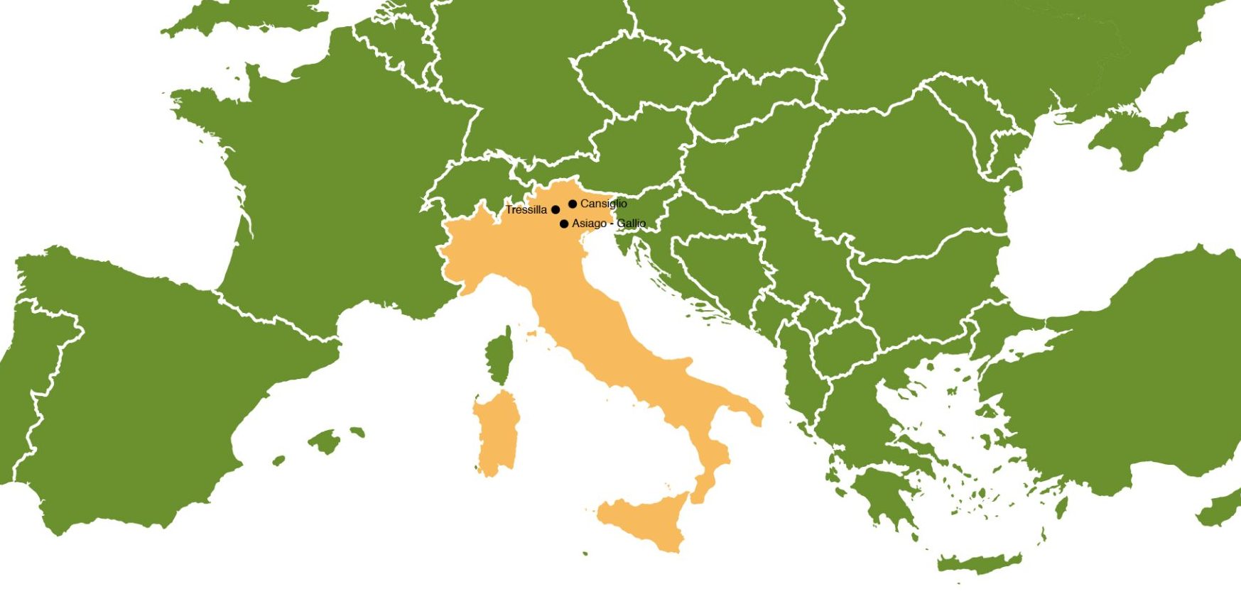
At the end of October 2018, the central and eastern Alpine slope was affected by an exceptionally intense meteoric event (Storm Vaia), characterised by concentrated heavy rainfall and particularly strong winds, nearly 200 km/h. The province of Trento was one of the areas worst hit by the event, which caused, among other things, the felling of a huge mass of wood over a total area of almost 20,000 hectares (mainly concentrated in the eastern valleys of the province) and the damage to many infrastructures serving the forest.
Among the worst affected areas of the provincial territory is the Pine’ plateau, and the property of the ASUC of Tressilla, owner of some wooded compartments located upstream of the town, also suffered considerable damage due to the felling of both extensive forest areas and forest roads.
The extent of the crashes on public and private property was estimated at a volume of over 120,000 m3. In addition, the area affected by the crashes and on which timber salvage work was carried out is crossed by three forest infrastructures that were heavily damaged by the event.
Since the first weeks after the event, the ASUC of Tressilla has been carrying out timber salvage works (now completed) and has undertaken the drafting of a programme of progressive restoration and rehabilitation of the affected areas (reforestation, change of use of certain sectors close to inhabited areas or at the edge of pasture areas, etc.).
After the Vaia event, the LIFE VAIA project was born: its objective is to restore forest areas and enhance their ecosystems, developing sustainable products and services. Through the application of innovative agroforestry techniques, LIFE VAIA aims to create opportunities for land recovery and increase the ecological, economic and social resilience of damaged forest ecosystems. The project is part of the European Union’s broader environmental strategy aimed at protecting forests from damage caused by climate change, strengthening local ecosystems and protecting biodiversity.
The LIFE VAIA project envisages the development of innovative intervention techniques for the reconstruction of forests, through which the adaptation of forest vegetation to climate change can be promoted. The highly innovative element of the project is the use of the agroforestry strategy as a solution to cope, in the short and long term, with the damage caused by extreme climatic events. This strategy makes it possible to invest in the production of organic products with minimal impact, increasing biodiversity and the sustainable use of resources (energy through renewable sources and water through rainwater harvesting). In addition, the production strategy focused on local resources and the rehabilitation of damaged areas make it possible to limit the economic damage suffered by the communities living in the affected areas.
The main actions financed by LIFE VAIA concern the reproduction and cultivation of wild blueberries and other ‘wild’ small fruits, food and medicinal plants in forest ecosystems, as well as the enhancement of bee production in forest areas destroyed by the storm.
PILOT SITES
At the heart of the Life VAIA project are the so-called pilot sites: each of these is designed with a surface area of 2.5 ha, equivalent to a square of 160 metres per side.
Each pilot site:
– lies within a pilot area of approximately 1 km x 1 km, i.e. with a surface area of 1 km2
– contains within it 2 or more cultivation areas, totalling 0.8 ha (e.g. 2 small cultivation areas of 0.4 ha each, or 4 small cultivation areas of 0.2 ha each, and so on)
In the framework of this project, the ASUC of Tressilla has made 15 ha of forest property available. The project envisages the creation, within an area on the 15 ha property of the ASUC of Tressilla, of 2 pilot sites of 2.5 ha each, which fall both on areas more than 95% affected by tree stand collapse and on portions of forest still standing.
In ‘Pilot site no. 1’, the planting of medicinal and alimurgical species is planned on two adjacent areas of 0.12 ha and 0.68 ha; in ‘Pilot site no. 2’, located a little further upstream than the previous one, two separate areas of 0.12 ha and 0.68 ha are planned, within which medicinal and alimurgical species will be planted. In the remaining parts of the two pilot sites, broad-leaved tree seedlings will be planted (chestnut, oak, cherry, rowan, linden, sycamore, sycamore maple and mountain elm). All planting areas will be fenced off in order to facilitate their identification, prevent damage by people and contain damage caused by fauna.
In the Pian del Cansiglio area, areas have been identified that were most affected by the disturbance and, as a result, suffered severe damage, especially on the Norway spruce (Picea abies), which grew in monospecific and even-aged stands, undermining its resistance to extreme climatic events and making it more susceptible to damage from strong winds.
In Pian del Cansiglio, two Pilot Areas have been identified, with a surface area of 1 km², which contain Pilot Sites, each of 0.025 km² (2.5 ha). The latter constitute the actual action area of the project, hosting the new agroforestry crops.
Location of the Pilot Areas and Pilot Sites
The two Pilot Areas identified for the purposes of the project fall within the Cansiglio State Forest, owned by the Veneto Region and managed by Veneto Agricoltura. Both areas, with a surface area of 1 km², were identified on the basis of the intensity of the damage caused by the storm Vaia in 2018, which, as already mentioned, caused massive crashes, especially of spruce and drastically modified the stand.
The first area (AP1) is located in correspondence with Valmenera, partially covering a flat area, part of which belongs to the “Pian di Landro – Baldassare” Oriented Nature Reserve, and an area of slope facing south and south-west in correspondence with Costa Canella.
The second Pilot Area (AP2), located further north, is cut in the centre by the presence of the Perosa stream and is bordered to the south-east by Pian Canaie, extending in a northerly direction as far as Valle del Pisot in the area immediately adjacent to the S. Anna settlement, and to the north-west between Col Saler and the ‘Via Montagna’ road of the Spert settlement.
Within the two Pilot Areas, two Pilot Sites have been identified, of more restricted extension, where the project interventions will be carried out, i.e. the cultivation areas, the installation of the apiaries and the creation of the catchment areas.
The first Pilot Site (SP1) was chosen in the flat area of Valmenera at an average altitude of 930 m (Photo 2-2).
The second area (SP2), located further north, is also situated in a flat area between the Pian dei Spin and Col Saler, near the village of S. Anna, at an average altitude of 1016 m.